
Horsham District Nature Recovery Networks
A Nature Recovery Network is a joined-up system of places important for wild plants and animals, on land and at sea. It allows plants, animals, seeds, nutrients and water to move from place to place and enables the natural world to adapt to change. It provides plants and animals with places to live, feed and breed. It can only do this effectively if, like our road network, it is treated as a joined-up whole.
Working closely with local communities and landowners, Wilder Horsham District aims to develop a Nature Recovery Network for the District that reverse the decline in species and habitats and enrich the natural environment for all residents and visitors. The network will create wildlife corridors to allow species to move freely from place to place.
This project will help to protect and enhance wildlife at a district level. It will also contribute to the wider vision for a ‘Wilder Future’, the Sussex Wildlife Trusts’ national campaign for a UK-wide Nature Recovery Network.
The need for networks in Horsham District
The Horsham District has a high quality and valued landscape. The southern part of the District is within the South Downs National Park and the High Weald Area of Outstanding Natural Beauty covers the north eastern area. It also has numerous sites that are protected because of their value to wildlife. This ranges from international sites such as the Arun Valley Ramsar site with a significant diversity of species, through to Sites of Special Scientific Interest like St Leonard’s Forest and numerous locally important areas, such as Woods Mill, in Small Dole and Chesworth Farm, near Horsham.
The wider countryside also contains a wide variety of habitats that support numerous different species. Our Nature Recovery map shows the protected and important habitats found in the Horsham District.
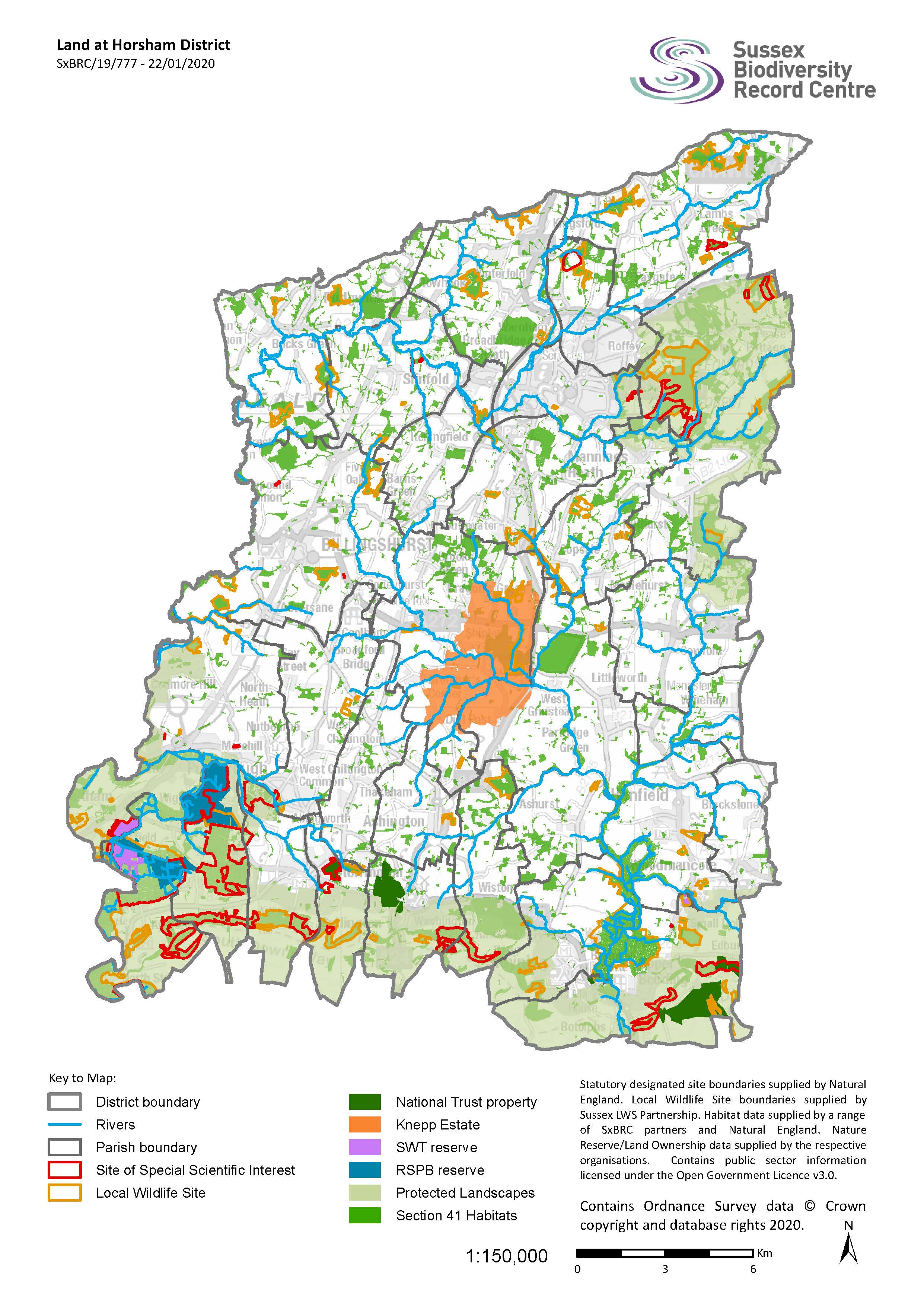
One of the main challenges is that habitats (whether they are protected or not) are becoming increasingly fragmented and isolated from each other. This does not allow species to move around, making wildlife less resilient to change; such as changes in land management or the climate.
Nature Recovery map
This map and associated document demonstrates what could be achieved and where action could be targeted to reverse the biodiversity crisis.
The Networks are based on the Lawton principles of: ‘Bigger’, ‘Better’, ‘More’ and ‘Joined Up’.
This first version of a map of a Horsham District NRN therefore identifies:
- where buffers could be added to existing sites (bigger),
- areas which can be improved (better),
- areas with high potential for nature recovery (more) and
- where there could be corridors or stepping stones between sites (joined up).
The map is still in development and will be improved and refined as more data is added.
View a map of the protected and important habitats found in Horsham District
Nature Recovery Network Report 2021
The publication of the Nature Recovery Network report marks a major milestone towards delivering the partnership’s priorities to recover the natural environment and enable landowners and community groups, residents and businesses to play a significant role as we move to a low carbon future.
The work takes advantage of the existing areas with biodiversity value and biodiversity potential, and considers how they could be best improved and linked together. The report forms the backbone of our pioneering work to create a ‘Wilder Horsham District’.